Old London maps
Thumbnail links to the original scans making up the layers in the site's Layered London map. Clicking on the blue link above each thumbnail opens a new page equipped with a viewer allowing zooming, panning, and full-screen display.
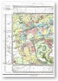
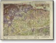
LAND UTILISATION 1930s
London part of a nationwide survey of land use intended as a 'modern-day Domesday book'. Much of the work was done by schoolchildren. Map images copyright the British Library.

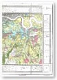
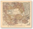
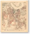
BOOTH POVERTY MAP 1898–99
A colour-coded map of London depicting levels of poverty and wealth. Commissioned by the social reformer Charles Booth. Map scans reproduced by kind permission of the London School of Economics.


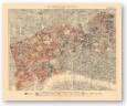


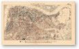

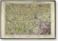
CRUCHLEY'S NEW PLAN OF LONDON 1849
1849 edition of the New Plan of London pocket map and street atlas series, begun in 1826 by the map publisher George Cruchley of Ludgate Street.

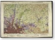
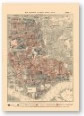
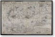
ORDNANCE SURVEY FIRST SERIES
London map derived from four separate sheets of the Ordnance Survey First Series, published from 1805 onwards. Map images copyright the British Library


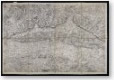
THOMAS MILNE LAND USE 1800
Pioneering map-maker and surveyor Thomas Milne was among the first to use triangulation and colour-coding. 12 different land use types are displayed in and around London.