SHARE THIS PAGE

Hampstead, Tufnell Park, Camden

Layered map for Hampstead, Tufnell Park, Camden with field recordings and historical maps. Use the navigator map insert below to explore other areas.

OpenStreetMap

London map OpenStreetMap for Hampstead, Tufnell Park, Camden

Land Use 1936

London map 1930s Land Utilisation Survey for Hampstead, Tufnell Park, Camden

Booth 1898

London map Booth Poverty Map for Hampstead, Tufnell Park, Camden

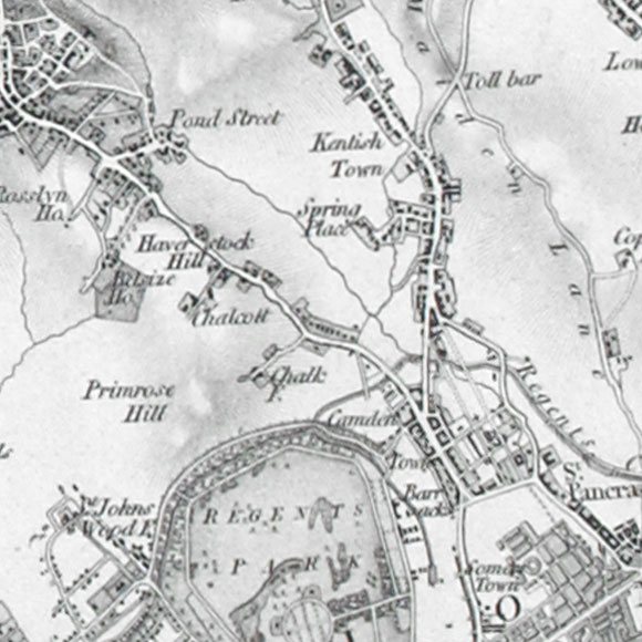
OS c. 1805

Ordnance Survey First Series map for Hampstead, Tufnell Park, Camden
Clamour of children's voices at the north end of Chalton Street Camley Street Natural Park overlooking the Regent's Canal Saturday night bacchanalia along Camden High Street The canal at Camden Lock Inside the Double Six old-school cafe on Eversholt Street Inside Swiss Cottage library Inside Camden Town library Sounds of Camden Stables market Sounds inside the Pembroke Arms pub Trains and announcements at St Pancras station Squeals of squirrel monkeys at London Zoo Echoing voices inside London Zoo's reptile house Throaty squawking from London Zoo hyacinth macaws Grid centre recording for OS reference TQ 2835 8447
LONDON MAP CREDITS: OpenStreetMap image displayed under the terms of their Creative Commons Attribution-ShareAlike 2.0 licence. Land Utilisation Survey and Ordnance Survey First Series map images copyright British Library. Booth London Poverty map courtesy of the London School of Economics.

Sound player

Map keys